Bentonville
XNA
Northwest Arkansas National Airport

United States
Departures


Northwest Arkansas National Airport
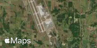
Northwest Arkansas National Airport (XNA) serves Bentonville, United States, and sits about 15 miles from the city center. The airport is positioned at an elevation of 1,287 feet, which is relatively high for a commercial airport and can influence aircraft performance and approach characteristics in ways travelers may notice during takeoff and landing.
Traffic at XNA is primarily domestic, connecting the region to other major hubs within the United States. The route pattern reflects a network built around linking this part of the country to larger metropolitan centers, supporting both business and leisure travel across the domestic market. The airport does not show evidence of international connections, pointing to its role as a regional gateway rather than a long-haul hub.
Given its elevation and inland location, XNA is worth noting for travelers tracking turbulence forecasts, since higher-elevation airports can experience different atmospheric conditions during ascent and descent compared to sea-level airports. Those flying into or out of this airport as part of a domestic itinerary should consider how the terrain and elevation may factor into typical flight conditions for the region.
Height above sea level
1287 ft
Distance to city
15 miles
Traffic volume
30 flight per day
Satellite