Windhoek
WDH
Windhoek Hosea Kutako International Airport

Namibia


Arrivals
Windhoek Hosea Kutako International Airport
Windhoek Hosea Kutako International Airport (WDH) serves Windhoek, the capital of Namibia. The airport lies approximately 24 miles from the city center, a distance travelers should factor into their journey planning when connecting to onward transport. At an elevation of 5,640 feet, WDH sits considerably higher than most coastal airports, which affects aircraft performance and can influence takeoff and landing distances, particularly in warmer conditions when air density decreases further.
The airport's high-altitude setting is a defining characteristic for pilots and airlines operating there, as the thinner air at this elevation requires careful consideration of engine performance and runway length. Travelers flying into or out of Windhoek should be aware that this elevation, combined with Namibia's typically warm and dry climate, contributes to specific operational conditions distinct from sea-level airports. For those planning trips to or from Windhoek, understanding the airport's distance from the city and its elevated position provides useful context for the overall travel experience, from ground transportation timing to general awareness of the local aviation environment.
Height above sea level
5640 ft
Distance to city
24 miles
Traffic volume
10 flight per day
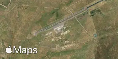
Satellite