Campinas
VCP
Viracopos-Campinas International Airport

Brazil
Departures


Viracopos-Campinas International Airport
Viracopos-Campinas International Airport (VCP) serves the city of Campinas in Brazil, located approximately 12 miles from the city center. The airport sits at an elevation of 2,170 feet above sea level, a factor that can influence aircraft performance and approach procedures compared to airports closer to sea level.
Situated in the interior of São Paulo state, Viracopos-Campinas functions as a key aviation gateway for the region surrounding Campinas, supporting connections that link this part of Brazil with other destinations. Its elevated position relative to coastal airports means pilots and travelers may experience different atmospheric conditions on approach and departure, including variations in air density that can affect climb rates and turbulence sensitivity in the surrounding airspace.
Travelers using Viracopos-Campinas should note the airport's inland location, which places it in a different meteorological zone than coastal Brazilian airports, potentially exposing flights to distinct weather patterns associated with the interior highlands. The 12-mile distance to Campinas makes ground transportation a manageable part of the journey for those connecting to or from the city. As with any airport at this elevation, travelers should be aware that atmospheric conditions at higher altitudes can occasionally contribute to different turbulence experiences during ascent and descent phases of flight.
Height above sea level
2170 ft
Distance to city
12 miles
Traffic volume
85 flight per day
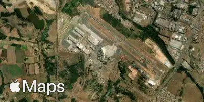
Satellite