Sarasota
SRQ
Sarasota Bradenton International Airport

United States
Departures




Sarasota Bradenton International Airport
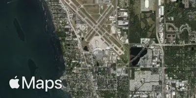
Sarasota Bradenton International Airport (SRQ) serves Sarasota, United States, and lies approximately 6 miles from the city center. The airport sits at an elevation of 27 feet above sea level, a low coastal setting typical of Florida's Gulf Coast region.
Departures from SRQ include service to the northeastern United States, reflecting connections between Florida and other domestic regions. This pattern points to an airport that primarily supports domestic travel within the United States, linking Florida's Gulf Coast to other parts of the country rather than functioning as a major international gateway.
Given its low elevation and coastal Florida location, travelers using SRQ can expect flight conditions typical of the region, with the airport's modest elevation meaning minimal terrain-related influence on approach and departure paths. Its role as a connector between Florida and other domestic markets makes it a practical option for travelers heading to or from the Gulf Coast area, whether for business or leisure purposes tied to the greater Sarasota and Bradenton region.
Height above sea level
27 ft
Distance to city
6 miles
Traffic volume
40 flight per day
Satellite