San Jose Cabo
SJD
Los Cabos International Airport

Mexico
Departures


Los Cabos International Airport
Los Cabos International Airport (SJD) serves San Jose Cabo, Mexico, and lies approximately 6 miles from the city center. The airport sits at an elevation of 358 feet above sea level, a factor that has a modest effect on aircraft performance during takeoff and landing compared with sea-level airports.
As a major gateway for the Baja California Sur region, Los Cabos International Airport handles substantial international traffic, connecting travelers from North America and beyond to this popular coastal destination. The airport's role as a resort-oriented hub means it experiences significant seasonal fluctuations in flight volume, with peak periods typically aligning with vacation travel patterns. Its position on the Baja California peninsula, bordered by desert terrain and coastal waters, places it in a geographic setting where local wind patterns and temperature variations can influence flight conditions, particularly during approach and departure phases when aircraft are at lower altitudes and more sensitive to surface-level atmospheric changes. Travelers using this airport should be aware that its coastal desert location combines with its elevation to create a distinct operating environment compared to inland or higher-altitude airports.
Height above sea level
358 ft
Distance to city
6 miles
Traffic volume
25 flight per day
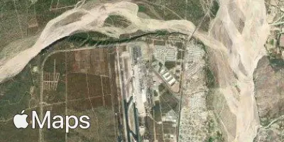
Satellite