Santa Barbara
SBA
Santa Barbara Municipal Airport

United States
Departures


Santa Barbara Municipal Airport
Santa Barbara Municipal Airport (SBA) serves the city of Santa Barbara in the United States, located about 8 miles from the city center. The airport sits at an elevation of just 10 feet above sea level, making it one of the lower-lying airports on the West Coast.
Flight activity at Santa Barbara Municipal Airport reflects a domestic focus, with connections linking the airport to major hubs in the interior of the United States. The traffic pattern points to a regional airport that relies on established domestic carriers to feed passengers into larger connecting hubs, rather than offering extensive direct long-haul or international service. This makes SBA a practical gateway for travelers heading to or from central and midwestern parts of the country, typically requiring a connection for destinations beyond North America.
Given its low elevation and coastal Southern California setting, travelers should be aware that marine layer conditions and coastal weather patterns can influence operations at certain times of year. The airport's proximity to the city, just 8 miles away, makes it a convenient option for travelers to and from Santa Barbara, despite its smaller scale compared to major metropolitan airports.
Height above sea level
10 ft
Distance to city
8 miles
Traffic volume
50 flight per day
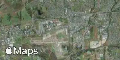
Satellite