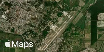
San Pedro Sula
SAP
Ramon Villeda Morales International Airport

Honduras


Arrivals
Ramon Villeda Morales International Airport
Ramon Villeda Morales International Airport (SAP) serves San Pedro Sula, Honduras, and lies approximately 5.2 miles from the city center. The airport sits at a low elevation of 104 feet above sea level, which places it in a tropical lowland setting typical of Honduras's Caribbean coastal region.
Given its low elevation and proximity to the city, travelers can expect a relatively short transfer between the airport and San Pedro Sula itself, making it a convenient gateway for both business and leisure travelers visiting this part of Honduras. As one of the country's principal air links, the airport plays an important role in connecting the region to international destinations, supporting the flow of passengers into and out of northern Honduras.
For travelers monitoring turbulence forecasts, it is worth noting that the airport's coastal lowland location means flights arriving and departing may experience weather patterns typical of tropical climates, including seasonal shifts in wind and precipitation. Understanding the airport's setting close to sea level and near the coast can help travelers anticipate the general flying conditions associated with this region, particularly during transitions between wet and dry seasons common to Central America's Caribbean side.
Height above sea level
104 ft
Distance to city
5.2 miles
Traffic volume
30 flight per day
Satellite