San Salvador
SAL
El Salvador International Airport

El Salvador


El Salvador International Airport
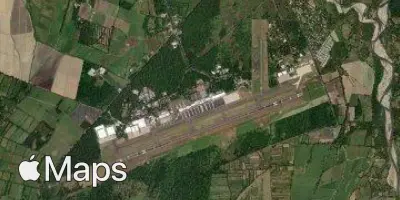
El Salvador International Airport (SAL) serves San Salvador, the capital of El Salvador. The airport lies 31 miles from the city center, a considerable distance that travelers should factor into their journey planning when arranging ground transportation to or from the terminal. Situated at an elevation of 101 feet above sea level, the airport sits close to sea level, which is a relevant consideration for aircraft performance calculations, particularly on warmer days.
Given its location and function as the principal international gateway for El Salvador, the airport primarily handles traffic connecting Central America with other regions across the Americas. Travelers using this airport should account for the extended transfer time between the airport and downtown San Salvador when scheduling arrivals and departures. The relatively low elevation of the airport means standard atmospheric conditions prevail for most operations, without the density altitude concerns that affect higher-elevation airports. As the main air link for the country, SAL functions as a key point of entry and departure for those traveling to or from El Salvador, whether for business, tourism, or onward connections within the wider Central American region.
Height above sea level
101 ft
Distance to city
31 miles
Traffic volume
50 flight per day
Satellite