Providence
PVD
Rhode Island T. F. Green International Airport

United States
Departures


Rhode Island T. F. Green International Airport
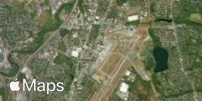
Rhode Island T. F. Green International Airport (PVD) serves Providence, Rhode Island, and lies approximately 7 miles from the city center. The airport sits at an elevation of 55 feet above sea level, a low-lying position typical of coastal New England airfields.
Traffic at PVD reflects a domestic-focused profile, with connections linking Providence to other points within the United States. The airport functions as a regional gateway rather than a major international hub, primarily serving travelers moving within the domestic air network. This scale of operation makes it a practical option for passengers seeking access to the greater New England area without the congestion typically associated with larger metropolitan airports.
For travelers flying from or to PVD, the airport's modest elevation and coastal proximity are relevant considerations when assessing potential weather and turbulence patterns, particularly during seasonal shifts common to the Northeast. Its relatively short distance from downtown Providence makes it a convenient option for regional travel, whether for business or leisure purposes, within the broader domestic United States travel network.
Height above sea level
55 ft
Distance to city
7 miles
Traffic volume
54 flight per day
Satellite