Ponce
PSE
Ponce Mercedita Airport

Puerto Rico
Departures


Arrivals
Ponce Mercedita Airport
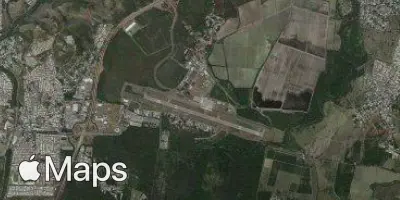
Ponce Mercedita Airport (PSE) serves the city of Ponce in Puerto Rico. The airport lies approximately 5 miles from the city center, making it a convenient point of access for travelers heading to or from Ponce. At an elevation of 29 feet above sea level, the airport sits close to sea level, consistent with its location on the southern coast of Puerto Rico.
Given its low elevation and coastal setting, flights operating to and from Ponce Mercedita Airport typically encounter conditions shaped by the surrounding terrain and maritime environment of southern Puerto Rico. Travelers using this airport can expect an experience reflective of a regional gateway, connecting Ponce to broader travel networks within the Caribbean and beyond. The airport's modest elevation means minimal high-altitude terrain effects near the airfield itself, though flight conditions can still be influenced by the tropical climate typical of the region.
Height above sea level
29 ft
Distance to city
5 miles
Traffic volume
10 flight per day
Satellite