Pittsburgh
PIT
Pittsburgh International Airport

United States
Departures


Pittsburgh International Airport
Pittsburgh International Airport (PIT) serves the city of Pittsburgh, United States, and lies about 20 miles from the city center. The airport sits at an elevation of 1,204 feet.
The route pattern out of Pittsburgh International Airport points to a primarily domestic network, with connections reaching across the United States. Departures link the airport to destinations in the southeastern and central regions of the country, while arriving flights similarly draw from major hubs within the domestic system. This pattern suggests a facility oriented toward connecting traffic within North America rather than serving as a major international gateway, typical of a mid-sized regional airport supporting business and leisure travel across the continent.
Travelers using Pittsburgh International Airport should expect a route network built around domestic hub connections, making it a practical point for onward travel to other major American cities rather than direct long-haul international service. The airport's elevation and distance from downtown Pittsburgh are useful planning details for ground transportation and flight timing.
Height above sea level
1204 ft
Distance to city
20 miles
Traffic volume
180 flight per day
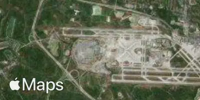
Satellite