Penang
PEN
Penang International Airport

Malaysia
Departures



Arrivals
Penang International Airport
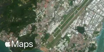
Penang International Airport (PEN) serves Penang, Malaysia, and sits about 11 miles from the city center. The airport lies at an elevation of just 11 feet above sea level, placing it firmly within the low-lying coastal terrain typical of this part of Malaysia.
Given its proximity to sea level and coastal location, travelers should note that airports at such low elevations often experience localized weather patterns influenced by nearby bodies of water, including humidity and occasional convective activity common to tropical regions. The short distance between the airport and the city center makes ground transfers quick and straightforward for most travelers.
While specific traffic patterns are not detailed here, Penang International Airport's role as a gateway to this part of Malaysia means travelers should plan according to standard tropical airport considerations, including seasonal weather variability. Its low elevation and coastal setting are the airport's most distinctive physical characteristics, factors worth keeping in mind when preparing for arrival or departure.
Height above sea level
11 ft
Distance to city
11 miles
Traffic volume
60 flight per day
Satellite