Inverness
INV
Inverness Airport

United Kingdom



Inverness Airport
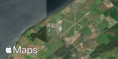
Inverness Airport (INV) serves Inverness, United Kingdom, and lies approximately 8 miles from the city centre. The airport sits at an elevation of 31 feet above sea level, making it a low-lying coastal facility in the Scottish Highlands.
Given its low elevation and proximity to the coast, the airport operates in a relatively flat setting compared to inland or mountainous airports at higher altitudes. Its position in the Highlands region places it in an area known for variable weather conditions influenced by its northerly latitude and exposure to Atlantic weather systems moving across Scotland.
No route or traffic data has been provided for Inverness Airport, so its specific connectivity and scale of operations cannot be characterized here. Travelers flying from or to this airport should note its modest elevation and short distance to the city centre as key practical details when planning ground transportation and considering local atmospheric conditions that may affect flight comfort.
Height above sea level
31 ft
Distance to city
8 miles
Traffic volume
12 flight per day
Satellite