Tehran
IKA
Tehran Imam Khomeini International Airport

Iran
Departures



Tehran Imam Khomeini International Airport
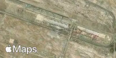
Tehran Imam Khomeini International Airport (IKA) serves the city of Tehran, Iran, located approximately 24 miles from the city center. The airport sits at an elevation of 3,281 feet, a factor that can influence aircraft performance and approach characteristics compared with sea-level airports.
As Iran's principal international gateway, IKA connects the capital with destinations across the surrounding region, reflecting a traffic pattern oriented toward international travel rather than short domestic hops. Its flight network links Tehran to nearby countries in the wider Caucasus and Middle Eastern region, supporting both business and leisure travel into and out of Iran. The airport's role as a hub for cross-border connections gives it a distinctly international character, with a scale suited to handling long-haul and regional traffic alike.
Travelers flying through IKA should account for its elevated position above sea level when considering flight conditions, as higher-altitude airports can experience different atmospheric behavior during takeoff and landing compared to airports closer to sea level. The distance between the airport and downtown Tehran means ground transportation time should be factored into overall travel planning. Given its function as a key international entry point for the region, IKA accommodates a steady flow of travelers moving between Iran and neighboring parts of the world.
Height above sea level
3281 ft
Distance to city
24 miles
Traffic volume
150 flight per day
Satellite