Hobart
HBA
Hobart Airport

Australia


Hobart Airport
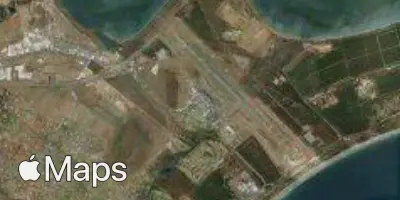
Hobart Airport (HBA) serves Hobart, the capital of Tasmania, Australia. The airport lies approximately 11 miles from the city center, making it a relatively short transfer for arriving and departing travelers. At an elevation of 13 feet above sea level, it sits close to sea level, which is a relevant factor for pilots and passengers considering local weather patterns and air density conditions.
Given its low elevation and coastal position in southern Tasmania, Hobart Airport is exposed to the maritime weather systems that frequently move through the region, including strong winds associated with the Southern Ocean's weather patterns. Travelers flying into or out of Hobart should be aware that Tasmania's geography and its position relative to prevailing westerly wind belts can influence flight conditions, particularly during approach and departure phases when aircraft are closer to the ground and more sensitive to gusts and turbulence near the terrain.
As the primary air gateway to Tasmania, Hobart Airport connects the island to the rest of Australia, supporting both domestic travel within the country and onward connections for those exploring or departing the island state. Its role as a regional hub reflects Tasmania's reliance on air transport for connectivity to the Australian mainland.
Height above sea level
13 ft
Distance to city
11 miles
Traffic volume
25 flight per day
Satellite