Hanoi
HAN
Hanoi Noi Bai International Airport

Viet Nam
Departures




Arrivals
Hanoi Noi Bai International Airport
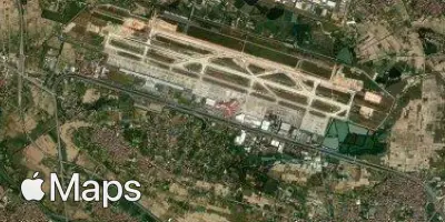
Hanoi Noi Bai International Airport (HAN) serves the capital of Viet Nam, located approximately 28 miles from central Hanoi. The airport sits at an elevation of 39 feet above sea level, a low-lying position typical of the Red River Delta region in which Hanoi is situated.
As the primary gateway to northern Viet Nam, Noi Bai International Airport connects the capital to destinations across Asia and beyond, handling a mix of domestic and international traffic. Its role as a major hub reflects Hanoi's importance as a political, cultural, and economic center, with flight connections spanning both regional Southeast Asian routes and longer-haul international services to other continents. Travelers using this airport can expect a blend of short regional hops and extended international journeys, reflecting the airport's function as a significant node in Asian air travel.
Given its low elevation near sea level, the airport's surrounding terrain is relatively flat, consistent with its delta location. The distance between the airport and the city center means travelers should factor in adequate transit time when planning arrivals or departures. As a key international airport for Viet Nam, Noi Bai accommodates a broad spectrum of air traffic, supporting Hanoi's connectivity to the wider region and to international destinations further afield.
Height above sea level
39 ft
Distance to city
28 miles
Traffic volume
250 flight per day
Satellite