Grand Rapids
GRR
Grand Rapids Gerald R. Ford International Airport

United States
Departures



Grand Rapids Gerald R. Ford International Airport
Grand Rapids Gerald R. Ford International Airport (GRR) serves Grand Rapids, Michigan, in the United States. The airport sits at an elevation of 793 feet and is located about 13 miles from the city center it serves.
Traffic at GRR is primarily oriented toward domestic connections within the United States, linking Grand Rapids to major metropolitan areas along the East Coast. The airport's route network reflects its role as a regional gateway rather than a large international hub, with scheduled service operated by major U.S. carriers connecting travelers to key business and leisure destinations across the country.
For travelers flying into or out of Grand Rapids, the airport's elevation of nearly 800 feet is a modest factor compared to higher-altitude airports, and its relatively short distance to the city center makes it a convenient option for both business and leisure travel. Given its domestic focus, most flights to and from GRR will involve shorter to medium-haul routes within the continental United States, connecting the region to larger hub airports for onward travel.
Height above sea level
793 ft
Distance to city
13 miles
Traffic volume
70 flight per day
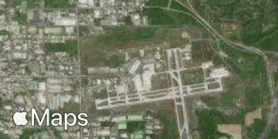
Satellite