Cairo
CAI
Cairo International Airport

Egypt
Departures




Cairo International Airport
Cairo International Airport (CAI) serves Cairo, Egypt, and sits about 11 miles from the city center at an elevation of 382 feet above sea level.
The airport's traffic pattern reflects its role as a major hub connecting Egypt with destinations across Europe and the Middle East. Flights departing Cairo reach into Southern Europe, while arriving traffic includes connections from the Arabian Peninsula, underscoring the airport's function as a bridge between these regions. This positioning makes CAI a significant gateway for travelers moving between North Africa, Europe, and the Gulf states, supporting both regional and intercontinental air travel.
Given its elevation of 382 feet, the airport sits at a relatively low altitude, typical of major coastal and near-coastal hubs in the region. Its distance of 11 miles from central Cairo places it within reasonable reach of the city, making it a practical option for travelers needing quick access to the capital. The combination of its geographic location and the international scope of its connections makes Cairo International Airport an important node for air travel linking Africa, Europe, and the Middle East, serving both business and leisure travelers moving through this well-connected part of the world.
Height above sea level
382 ft
Distance to city
11 miles
Traffic volume
300 flight per day
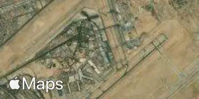
Satellite