Baltimore
BWI
Baltimore Washington International Airport

United States
Departures


Arrivals

Baltimore Washington International Airport
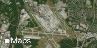
Baltimore Washington International Airport (BWI) serves Baltimore, United States, and lies approximately 9 miles from the city center. The airport sits at an elevation of 146 feet above sea level, a relatively low altitude that places it close to sea level compared to many other airports.
Traffic through BWI is predominantly domestic, connecting Baltimore with destinations across the United States. The route pattern reflects strong links along the East Coast, extending toward the northeastern United States as well as southern coastal regions of the country. This points to an airport that functions primarily as a domestic hub rather than a major international gateway, with connections concentrated within North America.
For travelers, BWI's proximity to the city center at just 9 miles makes it a convenient option for those needing quick access to Baltimore. Its low elevation of 146 feet means it does not face the kind of terrain-related weather complications that can affect airports at higher altitudes. The domestic-focused route network suggests travelers using BWI are largely journeying within the United States, with the airport serving as a practical connector for regional and cross-country travel along the eastern seaboard and beyond.
Height above sea level
146 ft
Distance to city
9 miles
Traffic volume
100 flight per day
Satellite