Bogota
BOG
Bogota El Dorado International Airport

Colombia
Departures


Bogota El Dorado International Airport
Bogota El Dorado International Airport (BOG) serves Bogota, the capital of Colombia, and lies about 10 miles from the city center. It sits at an elevation of 8,361 feet, making it one of the highest major airports in the world.
The airport's high-altitude location affects aircraft performance, as thinner air at this elevation requires longer takeoff distances and can influence engine and climb performance compared to sea-level airports. Travelers should also be aware that the surrounding terrain, given Bogota's position within the Andes mountain range, can contribute to localized wind patterns and turbulence near the airport, particularly during approach and departure phases of flight.
Given its role as the capital's main airport, El Dorado functions as a significant hub connecting Colombia to destinations across the Americas and beyond, reflecting a mix of domestic and international traffic typical of a major national gateway. Passengers flying into or out of Bogota should factor in the airport's mountainous surroundings and elevated altitude when considering flight conditions, as these geographic characteristics are inherent to the region and distinguish it from lower-lying airports elsewhere.
Height above sea level
8361 ft
Distance to city
10 miles
Traffic volume
650 flight per day
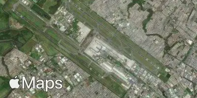
Satellite