Anchorage
ANC
Ted Stevens Anchorage International Airport

United States
Departures


Ted Stevens Anchorage International Airport
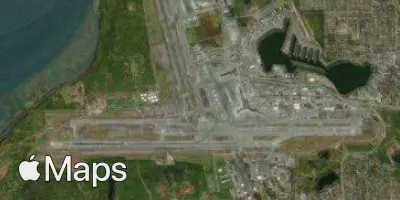
Ted Stevens Anchorage International Airport (ANC) serves Anchorage, United States, situated roughly 7 miles from the city center. The airport sits at an elevation of 144 feet above sea level, a modest height that keeps approach and departure procedures straightforward from a terrain perspective, though the surrounding Alaskan landscape and weather systems can still influence flight conditions.
The airport's traffic pattern reflects a strong connection to domestic destinations within North America, linking Anchorage to major hubs across the continent. This positions Anchorage as a key gateway for travelers moving between Alaska and the rest of the United States, supporting both business and leisure travel with links to significant metropolitan centers. The scale of operations suggests a facility well-equipped to handle steady domestic demand, characteristic of a regional hub serving a state with unique geographic and logistical needs. Anchorage's position makes it a natural staging point for connections further south, reinforcing its role in the broader North American air travel network. Travelers using ANC can expect a facility oriented primarily toward domestic routes, with connectivity that supports the flow of passengers and goods across the continent, reflecting Anchorage's importance as a transportation link in the region despite its relatively remote location within the United States.
Height above sea level
144 ft
Distance to city
7 miles
Traffic volume
130 flight per day
Satellite