Londrina
LDB
Aeroporto de Londrina

Brasil
Partidas


Aeroporto de Londrina
Londrina Governador Jose Richa Airport (LDB) serves the city of Londrina in the state of Paraná, Brazil. The airport sits at an elevation of 1,867 feet and lies approximately 4.5 miles from the city center, making it a convenient option for travelers heading into Londrina.
Given its elevation, flight crews and passengers may notice slightly different approach and departure characteristics compared to airports closer to sea level, particularly during periods of atmospheric instability common to inland regions of South America. The airport's proximity to the city makes ground transfers quick, which is an advantage for travelers with tight connections or short layovers in the region.
No specific route or traffic data is available for Londrina Governador Jose Richa Airport, so its scale and the character of its air connections cannot be detailed here. Travelers planning flights through LDB should consult current schedules for the most accurate information on service patterns and destinations. As with many regional airports in Brazil, conditions can vary with the season, and checking turbulence forecasts ahead of travel is recommended for a smoother journey to or from Londrina.
Altitude acima do nível do mar
569 m
Distância da cidade
7 km
Volume de tráfego
10 voos por dia
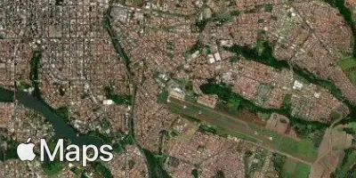
Satélite
Use a aplicação durante o voo.
Tenha a previsão do voo sempre à mão e receba atualizações dos dados com a nossa aplicação gratuita para telefone e tablet.