Stavanger
SVG
Stavanger Airport

Norway


Ankomster
Stavanger Airport
Stavanger Airport (SVG) serves the city of Stavanger, Norway, located approximately 7 miles from the city center. The airport sits at a low elevation of 29 feet above sea level, placing it close to sea level and typical of Norway's coastal airports along the North Sea.
Its position near the coast means flights arriving and departing Stavanger Airport often traverse maritime air over the North Sea, a factor that can influence local weather patterns and wind conditions experienced during approach and departure. Travelers using this airport should be aware that its low-lying, coastal location is characteristic of the region's exposure to Atlantic weather systems moving across Northern Europe.
Given its role serving Stavanger, a city with strong ties to the offshore energy sector, the airport supports a mix of domestic Norwegian connections and international links to other parts of Europe, reflecting both regional travel needs and broader continental connectivity. The relatively short distance between the airport and the city center makes it a convenient gateway for travelers, whether flying within Norway or connecting onward across Europe. Its coastal, low-elevation setting remains a defining physical characteristic for anyone planning travel through this airport.
Høyde over havet
9 m
Avstand til byen
11 km
Trafikkmengde
30 flygninger per dag
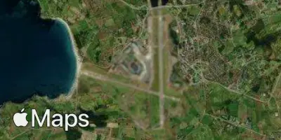
Satellitt
Bruk appen under flyturen.
Ta med deg prognosen for flyturen og få oppdaterte data med den gratis mobilappen vår.